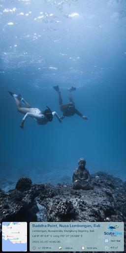
Enhance your photos with GPS Map Camera! Easily add location details including date, time, coordinates, weather, magnetic field, and compass direction to your images. Perfect for travel journals or documenting special locations, this app tracks your live position as you shoot, letting you share geotagged memories with friends and family.
GPS Map Camera offers customizable camera settings, diverse stamp templates, and options for manual or automatic location tagging. Whether you're a travel enthusiast, blogger, or simply want to add GPS data to your pictures, this app is invaluable. Download GPS Map Camera today and share your experiences – we welcome your ratings and reviews!
App Features:
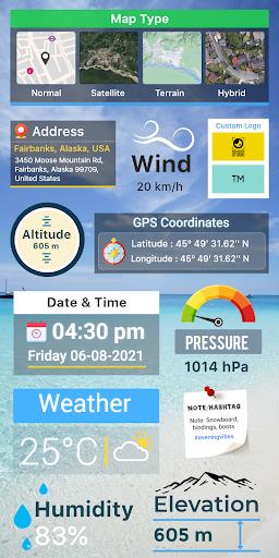
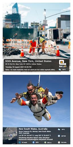
- GPS Photo Stamping: Add date/time, map, latitude, longitude, altitude, weather, magnetic field, and compass data to your photos.
- Geotag and Track: Track your live location while capturing photos.
- Easy Sharing: Share geotagged photos with family and friends to share your travel adventures.
- Customizable Camera: Enjoy features like gridlines, aspect ratios, front/selfie camera, flash, focus, mirror, timer, and sound capture.
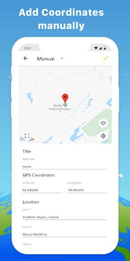
- Advanced Templates: Customize map type, add location manually or automatically, set GPS coordinates, add date/time stamps, include a logo, add notes, and hashtags.
- Comprehensive Tracking Data: Access wind speed, humidity, pressure, altitude, and location accuracy.
In Conclusion:
GPS Map Camera is a powerful tool for travelers, businesses, event planners, bloggers, and anyone wanting to enrich their photos with GPS information. Its intuitive design and extensive features make it a must-have for elevating your photography. Download GPS Map Camera now and let us know what you think!
Screenshot
